Statement
Duwamish Remains investigates Seattle's river, and its transformed watershed, as a historical geography. As a 21st Century witness, I seek moments along the river’s current and long-lost meandering course that connect its present, developed conditions to its complex, transfigured history.
Altered solely by forces of nature for millennia, the 20th Century unveiled to the Duwamish River a sustained period of human-wrought mutation. The fertile provider to native populations succumbed to the inevitable meddling hand of westward expansion. Seattle’s agrarian and industrial revolutions required predictability from its waterways, initiating flood control infrastructures still being developed today. Dammed, diverted, redirected, dredged, back-filled and run dry, between 1906 and 1916 the Duwamish River’s watershed was reduced to one quarter of its 1,600 square mile reach. In 2002, decades of industrial contamination led to the designation of the lower five miles of the Duwamish estuary as a federal Superfund cleanup site.
And yet, through all of this, the Duwamish remains.
Native populations embed directly within their grammar an awareness of a river that is alive. They also distinguish within the term ‘pre-contact’ a time immemorial prior to European arrival. This expression references a distinct historical moment in a way that evokes the tactile and physical, and one after which nothing would ever be the same. 100 years after human contact, Euro-Americans began to reconfigure the Duwamish watershed. This indigenous river, the implications of contact, and what remains, guide my concern.
River cartography of a ‘pre-contact’ condition, drawn by the hands of engineering and colonization, recorded this period of the Duwamish. Layered with present-day maps I am able to pinpoint locations within the current landscape where the waters once flowed. While these endeavors allow us to wander backwards, my images inevitably remain in the human/river ‘post-contact’ world.
I acknowledge that my photographs have been made on and of the traditional land of the first peoples of Seattle, including the Duwamish People past and present. Through my tracing of the histories of this terrain, I intend that the work honor the land itself and, in turn, all who have lived on it.
As you view the images and maps, please consider how this landscape must have looked and felt, for millennia, and how it has been transformed in merely a century and a half.
Timeline
10000 BC earliest evidence of human occupation within the original Duwamish watershed
1792 George Vancouver sails south into the Whulge and re-names it Puget Sound
1846 Oregon Treaty divides the Pacific Northwest at the 49th parallel claiming land to the south for the United States government
1855 Treaty of Point Elliott creates agreement with United States guaranteeing hunting and fishing rights and reservations to all Native signers.
1865 City of Seattle incorporated
1906 White River diverted toward Tacoma
1912 Cedar River routed north into Lake Washington
1913 commencement of the dredging of the Duwamish Waterway canal
1916 completion of the Lake Washington Ship canal and extinction of the Black River
1920 cessation of the dredging of the Duwamish Waterway canal
1961 completion of the Howard A. Hanson Dam on the Upper Green River
2002 declaration of the lower 5 miles of the Duwamish estuary as a United States government Environmental Protection Agency Superfund site
Watersheds
Prior to 1906, the Duwamish River brought 1,600 square miles of watershed to the Puget Sound. Lake Washington, the Cedar River, and the White River funneled through the Duwamish from locations as diverse as Mt Rainier and Lake Sammamish. Today’s Duwamish pulls water from the Cascade Mountains solely via the Green River and an approximate 400 square miles (blue).
A
White River Watershed, severed, 1906
Following decades in which colonizing farmers utilized dynamite to alter the natural course of the White River away from its Duwamish confluence, the 1906 flood forces a decisive diversion south to Tacoma. Duwamish watershed reduced by 490 square miles.
B
Cedar River Watershed, severed, 1912
As a means to rid Renton of its seasonal flooding, settlers terminate the Cedar River’s confluence at the Black River and route it northward into Lake Washington. Duwamish watershed reduced by 180 square miles.
C
Lake Washington Watershed, severed, 1916
To ensure a more viable path to the Puget Sound, settlers cut the Lake Washington Ship canal and lower Lake Washington by nine feet. This action terminates the Lake’s natural southward drainage into the Black River (B). As a result, the Black River runs dry. Duwamish watershed reduced by 590 square miles.
D
Duwamish Waterway, cut, 1913 to 1920
The cutting, dredging and backfill of the tidal zone of the Lower Duwamish River creates a 4.5 mile canal, assuring access for ships and commerce.

Photographs
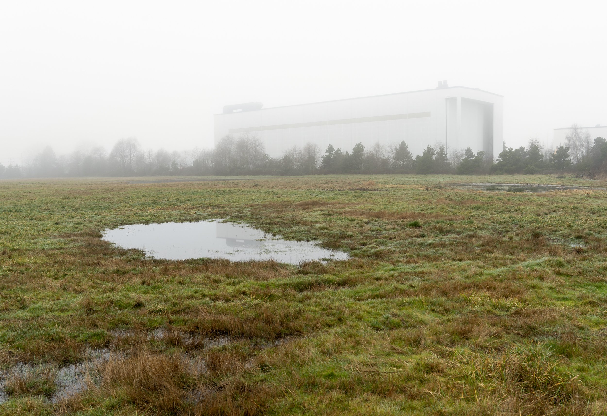
The Waterway : Between 1913 and 1920 the lower 9 miles of the Duwamish River were cut and straightened to create a canal of half that length. Simultaneously, the River’s meanders were back filled - ensuring an accessible, flood-free industrial landscape for Seattle. In 1920, this Dredging was suspended with a turning basin at present day Salmon Cove Park, though a few turn-of-the-Century visionaries hoped to extend it to Tacoma. To the north, at the mouth of the Duwamish, fill created Harbor Island. Upon completion, it was the largest human-built island on Earth.
The Last Meander : In 1976 Duwamish Tribe Chairwoman Cecile Hanson’s efforts saved ancestral remains and preserved the last remaining river meander. Today, the land formerly slated as Terminal 107 offers Herrings House and həʔapus Village Parks. To the east, Kellogg Island sits as a remnant of the dredging of the Waterway, having been severed from the eastward tidal flats. These west bank parks allow us to directly engage this avulsion, and a segment of the Duwamish Trail runs parallel, perched above the sole remaining meander. A vast majority of this land remains the property of the Port of Seattle.
Vestiges : In the years both during and following the dredging of the Waterway, the sweeping oxbows of the Duwamish delta were systematically filled, and the adjacent, neighborhoods acquired land. Vestiges of the river along the Waterway were retained as slips to accept barges and relieve flooding. Portions of the urban grid itself remain as they were at the turn of the 20th Century. Though environmentally and spiritually violent, this alchemy left in its wake clues to what it had taken away, and these remnants allow us to trace the otherwise lost meandering path. Boeing’s runways, Georgetown’s Fidalgo Street, and the appropriately named River Street, directly follow the course that the Duwamish had claimed for millennia.
Finding Hamm Creek : Hamm Creek’s namesake endorsed the Waterway in the early 20th century, and the urban development that followed frankensteined West Seattle’s 1400-acre tributary basin into three miles of culverts, pipes, and channels. The ravine cut by the creek’s south fork, used as a garbage dump for decades, was cleaned up and restored by the hands and tenacity of John Beal in the late 20th century. Today, the system daylights and reaches the Waterway through Seattle City Light property, and salmon can be found navigating the channel along the tree-lined base of a hangar housing the construction of luxury yachts.
The Extinct Black River : Indigenous peoples named the Black River ‘the river of two mouths’ due to its tidal and seasonal intermittent reversal. For millennia, this three-mile long connection delivered the 770 square mile Lake Washington and Cedar watersheds to the Duwamish at the confluence once referred to as ‘Meeting of Rivers.’ In 1916, canals cut at present day Montlake and Fremont neighborhoods created a new connection to Puget Sound at Shilshole Bay. This feat of engineering redistributed the watershed and dropped the Lake’s water level by nine feet. As a result, the Black River ran dry, grounding canoes and leaving fish flopping in the mud. A century later, its bed lies buried beneath Renton’s parking lots and speculative commercial construction. Today, a King County managed pump station regulates runoff from 25 square miles of suburban/industrial development to the south.
The Shallow Valley : Wide and shallow and prone to flooding, the modern story of the Green-Duwamish valley is one of controlling its waters. In the late 19th Century, feuding farmers used logs and dynamite to divert the flow of the White River back and forth from Seattle to Tacoma, from the Duwamish to the Puyallup Rivers. In 1906, massive overflow, backed by armed guards, forced a permanent path southward. In Auburn, White Lake Road approximates White River’s extinct connection to the Duwamish. At Game Farm Park, a 1,500 foot-long concrete diversion wall ensured that the river's waters flow to the Sound, via Tacoma, in perpetuity. In the first two decades of the 21st Century, hundreds of millions of dollars were spent in the City of Kent, maintaining and enhancing the infrastructure that tamed the River, and ensuring the value of the City’s private commercial and residential property.
Lake Washington Canal : One-half of Seattle’s population attended the official grand opening of the Ballard locks on July 4, 1917 to celebrate the long-awaited fresh-to-saltwater connection between Lake Washington and the Puget Sound. During the 70-year political journey to this day, significant time and money had been spent on at least 5 separate canal proposals through various Seattle topographies from Beacon Hill to Interbay. Fremont/Ballard/Shilshole won out, however this effort alone represented an 8-year drama of channels, cofferdams, breaches, bursts, mud slides, injunctions and lawsuits. Ultimately, two separate cuts through the landscape: from Lake Washington to Lake Union, and from Lake Union to Salmon Bay, combined to form the single canal that would reroute Lake Washington’s out-flow, render extinct Renton’s Black River, and remove a 1,120 square mile watershed from the Duwamish River.